Level Two notices are now in effect for houses north of Indian Ford Road; east of Green Ridge Road 11 and west of Fly Lake Road (USFS 2055) near Black Butte. People who live here must be prepared to leave at a moment's notice because there is significant danger to the area. People should either voluntarily relocate to a shelter or be ready to leave at any time. Residents may have time to gather up necessary belongings, but this comes at a risk. This may be the only notification from the sheriff's office.

Level One pre-evacuation notices were issued for houses along the south side of Indian Ford Road from Hwy. 20 to Stevens Canyon Road; residences east of Fly Lake Road (FS 2055) to Stevens Canyon Road (including all residences along Stevens Canyon Rd); and private residences and campgrounds west of USFS 14 within the Metolius Basin in the Camp Sherman area.
People who live in the Level One area must be ready for potential evacuation and closely monitor emergency services websites and local media outlets for information. This is the time for preparation and precautionary movements of persons with special needs, mobile property and (under certain circumstances) pets and livestock. If conditions worsen, emergency services personnel may contact you via an emergency notification system.
Everyone in Central Oregon is advised to avoid these evacuation areas and abide by any area closures by the Deschutes National Forest.
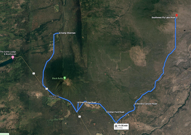
Screenshot via GoogleMaps
Please see official evacuation maps for the most updated evacuation areas at deschutes.org/emergency
Current maps including evacuation areas
deschutes.org/emergency
For fire information, visit the Central Oregon Fire Information site:
centraloregonfire.org