I had just deplaned a 19-hour red-eye trek from Maui to Bend, saltwater in my hair, sunscreen in my eyes and sand between my toes. Kerie picked me up at the airport and we headed straight to 10 Barrel for a coffee porter. Halfway through our beers, she mentioned something about going to Hawaii for the weekend. At least, that's what I heard in my sleep-deprived, porter and melatonin daze. I looked out the window at the late April snow flurries and said that sounded good to me.
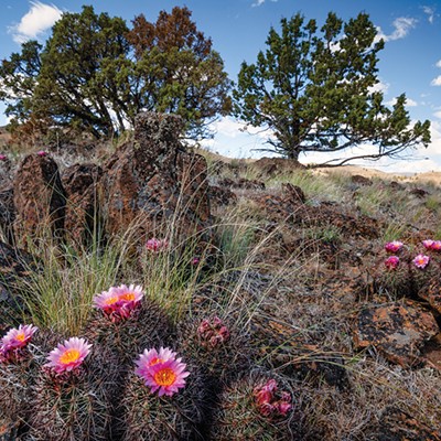
"Owyhee" is what she really said. It's actually an old spelling of "Hawaii." The Owyhee River was named for three Hawaiian trappers who disappeared while exploring the uncharted river in 1819. It is a 280-mile long tributary of the Snake that flows through parched and sparsley populated landscape of northern Nevada, southwestern Idaho and southeastern Oregon. For kayakers and rafters, though, the Owyhee River is a dramatic high-desert float, full of sheer volcanic canyons, dry washes, prickly terrain, rollicking rapids and sweet hot springs.
Some friends who ran the Middle Fork with us last summer were on the river, doing the standard 67-mile Owyhee run from Rome to Leslie Gulch. It's a non-permitted trip that features numerous Class II to III rapids punctuated by a couple of Class IVs, depending on water levels, with optimal flows that range between 1,000 and 8,000 cfs. Because it runs through such dry terrain, the Owyhee season is short, typically March to June. Now is prime time.
Our impromptu plan was to paddle four miles of flatwater from the take-out at Leslie Gulch for a surprise reunion at the Echo Rock Hot Spring. So we threw food, wine, camping gear and dry bags into the van and sea kayaks on the roof at 4 a.m. the next morning for the six-and-a-half-hour drive. To get there, drive to Burns and take a right. Don't forget to stop in Riley for your crappie jigs. From Highway 95, there's a 25-mile dirt road to get into Leslie Gulch, but even a Prius could do it and the red rhyolite hoodoos along the way are spectacular.
At Leslie Gulch we packed the kayaks and paddled lazily upriver, admiring the red cliffs and white pelicans. It wasn't difficult to locate the hot spring, which is marked by a white pipe and directly across the river from the tall wall of Echo Rock. We pulled the boats ashore and walked up a small hill to a large pool with an expansive view. It was full of clean, steaming water and one young, good-looking guy named Justin, so we plunged into the 103-degree water and luxuriated.
Within an hour, we spotted three rafts and three kayaks floating our way. Wrapped in a sarong, I climbed down the hill and greeted our friends with a hula dance. They pulled ashore, weary and wrapped in layers of neoprene. Apparently, it had been a cold, rainy, snowy and windy trip. It's not every day you find a friend randomly hula dancing in a sarong in a remote canyon on day five of a snowy river trip. I only wish I'd had leis to complete the greeting, but I did have the good news about the incredible hot spring.
The rest of the weekend pretty much went like this: soak-eat-soak-fish-soak-sleep-soak-eat-soak-hike-soak-eat-soak-fish-soak-sleep-soak-eat-soak-paddle-drive home. It was definitely one of the nicest hots springs I've ever found.
The hiking was fun, too, with countless hoodoos wooing you. We climbed to the top of the plateu above the hot spring for a magnificent view of the Owyhee Basin and the snowcapped Steens.
Fish were jumping out of the water right and left so I tried my hand at crappie fishing with a stick, some eight-pound test line, a crappie jig, a crappie niblet and a worm Justin gave me. Crappie, by the way, is "real good eatin' - better than halibut." At least that's what the guy in the Riley sporting goods store told me.
The Vale District BLM office (or.blm.gov/districts/vale, 541-473-3144) sells the Owyhee & Bruneau River Systems Boating Guide, replete with a highway map, mile-by-mile river description and shuttle contacts. During the float season, you can also call the river ranger (541-586-2612) at the Rome launch for up-to-the-moment river and weather reports.

