


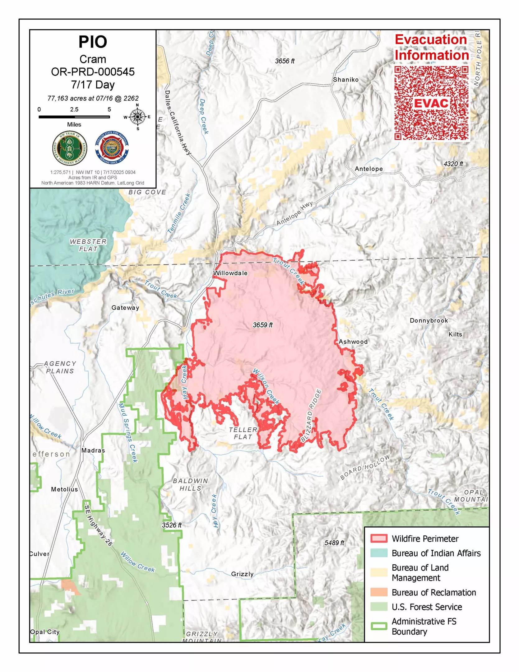
Fire crews made some progress in the Cram Fire 15 miles north of Madras, but 25 mph winds are forecast for Thursday afternoon. As of July 17, the fire is 77,163 acres. The northern part of the fire, along Highway 293, showed decreased fire activity Wednesday, allowing firefighters to continue securing the line, mopping up hot spots and patrolling that area. In anticipation of Thursday’s Red Flag Warning, crews focused on structure protection, and aviation operations continued in areas of increased heat.
A Red Flag Warning is in effect Thursday from 1pm to 10pm for dry, windy conditions. Winds will shift to the northwest, increasing to 10-15 mph with gusts up to 25 mph possible. Winds are expected to decrease overnight but may increase again on Friday before the passage of a cold front this weekend, which will bring cooler temperatures and higher humidity.
Northwest Complex Incident Management Team 10 joined the Oregon State Fire Marshal (OSFM) Green Team Wednesday. NW Team 10 spent the day shadowing their counterparts from the High Desert Type 3 Incident Management Team to ensure a seamless transition and continued coordination with the OSFM Green Team.
This effort is part of a strong interagency partnership among local, state, and federal responders, which totals 573 personnel, working together to protect lives, property, and natural resources.
On the southern edge of the fire, heavy equipment was utilized to complete and connect together unfinished fire lines. During the night shift, two additional strike teams of engines patrolled and mopped up to ensure those lines held through the night while personnel further bolstered structure protection.
Strategic firing operations were successfully implemented to remove unburned fuel east of Hay Creek between NE Old US Highway 97 and the fire’s edge. Firefighters will now focus on mopping up around structures in areas of minimal or no current fire activity.
North of East Ashwood Road, ground personnel working closely with aerial support, are constructing line directly on the fire’s edge where conditions allow. Fire managers continue to evaluate terrain, fire behavior and hazards to determine the safest and most effective tactics. Crews will monitor expected dynamic fire behavior throughout Thursday and focus on strengthening containment lines and tying together unconnected sections.
Evacuations remain in effect. Jefferson and Wasco County Sheriffs have issued Level 3 (GO NOW), Level 2 (BE SET), and Level 1 (BE READY) evacuations across multiple zones. An interactive smoke map is available at https://fire.airnow.gov.
This article appears in Source Weekly July 17, 2025.
MAKE LOCAL JOURNALISM HAPPEN

![]()


