The Oregon High Desert Grotto, Bend's chapter of the National Speleogical Society, records 690 known caves in Deschutes County alone. Just when I'd been in enough of the caves close to Bend—with their entrances christened with beer bottles, spray paint, and cigarette butts—to think, "Meh, seen one, seen 'em all," I learned of these three standouts.
Pictograph Cave
As the name suggests, this cave contains faded, but still visible, wall art left by Native Americans untold years ago. Pictograph cave is pretty large, with two wings, one of which goes on for about 1,000 feet. Mercifully, while this cave is close in to Bend, it has been spared from morons packing paint cans. For that reason, I won't reveal the exact location, but if you are really interested in checking it out, directions can be found with enough perusing of the interwebs.
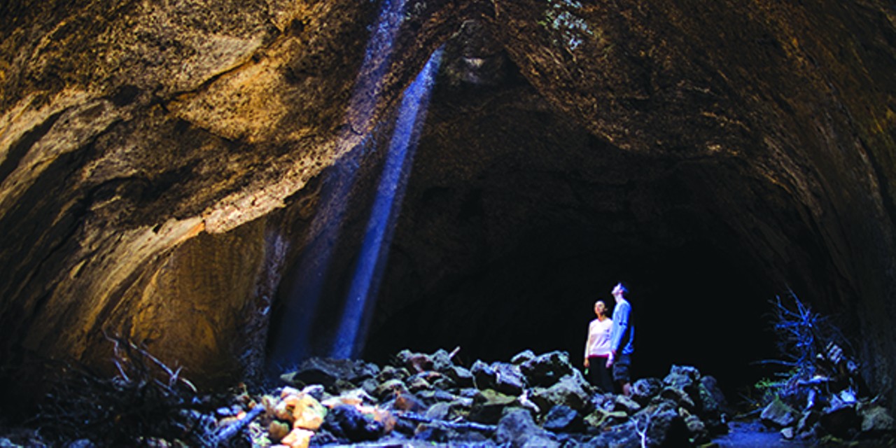
Skylight Cave
Thanks to the tilt of the earth on its axis and this cave's position on the planet, for the next month or so, if you can get out there before noon, this cave will bring back the feeling you had the first time you saw Goonies. The angle of the sun in early spring is such that midmorning rays shine directly through the three skylights in the cave's roof, sending three beams of light in to punctuate the surrounding darkness. This cave is unsigned and getting here involves a series of forest roads, which can be a little tricky. For good, detailed directions, see the Sisters Chamber of Commerce website at sisterscountry.com
Boca Cave
A little further flung, but the payoff is worth the effort. Located off the Triangulation Peak trail, this is a westside realtor's dream with its cathedral ceilings and a framed view of Mt. Jefferson. On a clear day you can also see also see Mt. Hood and the distant tip of Mt. Rainier. To get there, take Highway 22 to milepost 56.2, turn on McCoy Creek Road and follow it for eight-ish miles. Turn right at the four-way intersection, follow for 1 mile, then turn right on Forest Road 635. The trail head is apparent on the right. Take the trail for 1.5 miles until you come to an unsigned fork to the right. Take the fork .7 miles, which puts you at Triangulation Peak summit. Next, head NE along the ridge through obvious campsites, look for a path leading down from the last site, and say a Hail Mary if heights and edges aren't your thing. Continue down the nearly vertical path, past the mammoth rock ridge, and as you come around the left bend you'll see the cave entrance. Once inside, turn around and take in the view, that's what you came for.
Common Cave Sense:
Always bring at least two sources of light. Caves are cold; year round they maintain a temperature of roughly 40° F, dress accordingly. Most caves are important habitat for bats and other critters and are off limits October to May.